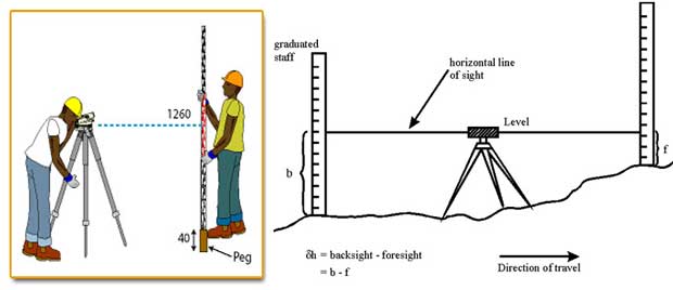
Levelling
- Levelling is the art of determining the relative elevations of points on, above, or below the Earth’s surface.
- It focuses on measurements in the vertical plane and is a branch of surveying used to find the elevations of points, establish points at a given elevation, or set out engineering works.

Key Terms in Levelling
- Level Surface: A curved surface that is perpendicular to the direction of gravity at every point (e.g., the surface of still water).
- Level Line: Any line lying on a level surface, normal to the plumb line at all points.
- Horizontal Plane: A plane tangential to the level surface at a specific point, perpendicular to the plumb line through that point.
- Horizontal Line: A line lying on the horizontal plane, tangential to the level line and perpendicular to the plumb line at the tangential point.
- Vertical Line: The direction indicated by a plumb line, perpendicular to the horizontal line.
- Vertical Plane: Any plane passing through the vertical line.
- Datum: A reference surface from which vertical distances are measured. Commonly, the Mean Sea Level (MSL) is used as the national datum.
- Benchmark: A permanent reference point with a known elevation relative to the datum. There are permanent benchmarks (for long-term use) and temporary benchmarks (for specific projects).